TUM Fitness Map
A local guide to sports facilities around TUM Main Campus, with walking zones and a clear visual hierarchy.
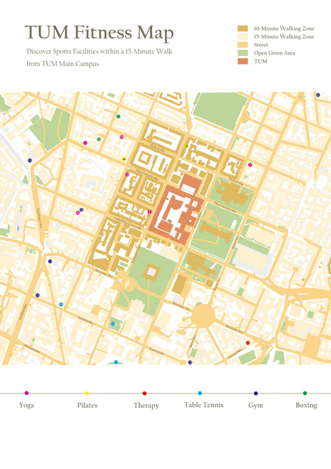
TUM Fitness Map
Sports facilities and 10- and 15-minute walking zones bring nearby options into one campus-area guide.
Visual organisation
Street and green-space context frame the walking zones. Coloured symbols distinguish yoga, Pilates, therapy, table tennis, gym and boxing.
Build the interface.
Understand the user.
I bring software prototyping, data analysis and user research to technical and product-focused teams.
xuweichen09@outlook.comGitHubRequest the full PDF portfolio
Full application materials available by email.