Cloudscapes of Schladming
Field observations and elevation data transformed into an illustrated Alpine panorama.
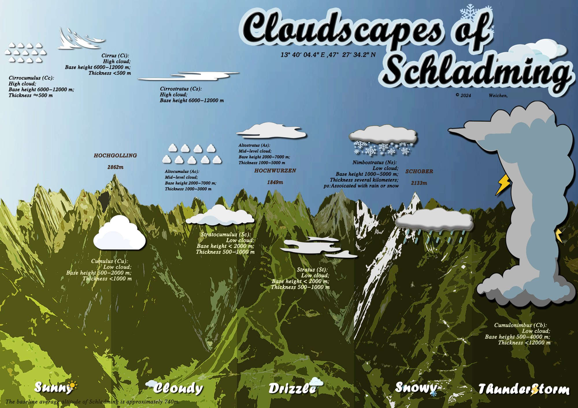
The project
A panoramic map brings terrain, cloud types and weather conditions into one visual explanation of the Alpine landscape.
My workflow
I processed field data, acquired and prepared the DEM, and worked on 3D terrain in ArcGIS Pro.
Team delivery
I contributed report writing and supported model design and map output. The final composition combines terrain with team-developed illustrations, graphic styling and typography.
Build the interface.
Understand the user.
I bring software prototyping, data analysis and user research to technical and product-focused teams.
xuweichen09@outlook.comGitHubRequest the full PDF portfolio
Full application materials available by email.